Please note: The trails section of the Huddart Park website is currently being updated to reflect changes made to the park trail system. Some of the maps and information below may be incorrect. See our current map or brochure for better information.
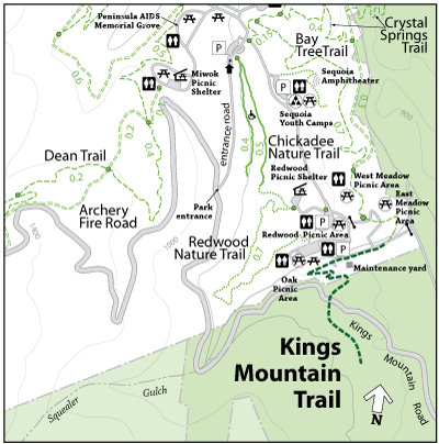
Beginning in a stunning location above the town of Woodside underneath towering redwoods and oak trees, the Kings Mountain Trail enters Huddart Park near Kings Mountain Road. The Trail meanders for approximately a ½-mile past a park service road and the East Meadow Picnic Area until it reaches the West Meadow Picnic Area. From West Meadow, the trail then forks into Richards Road Trail and Bay Tree Trail.
Park: Huddart Park
Open to: Equestrian, Hiking
Surface:Soil
Length:
0.70 miles
Elevation Change:
n/a