Please note: The trails section of the Huddart Park website is currently being updated to reflect changes made to the park trail system. Some of the maps and information below may be incorrect. See our current map or brochure for better information.
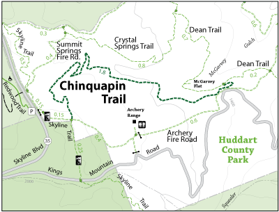
The Chinquapin Trail is a single track trail that runs east to west in the park. This trail connects to the Dean Trail and the Archery Fire Road. The park visitor will hike among huckleberry, toyon, redwood trees. There are two bridges that a user will cross. Chinquapin Trail is best used with the Crystal Springs Trail and Dean Trail to do an over seven-mile loop.
Park: Huddart Park
Open to: Equestrian, Hiking
Surface:Gravel, Soil
Length:
1.80 miles
Difficulty: Moderate
Elevation Change:
659 ft.